Panama Canal

February 6th, 2018

We finally got to the day when we boarded and started the Panama Canal tour.  Our boat was a catamaran that held 24 passengers.  It was docked in a small marina with other yachts—some very large!  The captain and crew were very friendly.  Our rooms were small but very adequate and we had wonderful food on board.

Our first visit was to Taboga Island which had originally served as a get-away for the white canal workers.  Known as the “Island of Flowers;” San Pedro is a colorful village.  Visited the second oldest continuously used church in the Western Hemisphere.  Built in 1527.  Paul Gauguin visited here in 1887.

The next morning our boat got in line ready to go through the first two sets of locks when we got the signal.  Every boat/ship (no matter how large or small) must have a Panama Canal pilot on board—and fly the Panama flag.  We went through the Miraflores and the Pedro Miguel locks.  We were teamed up with another small boat and 2 tugboats to go through the locks.

We traveled through the Culebra Cut.  This is a cut through the Continental Divide that was considered one of the great engineering feats of the time.  “Hundreds of large steam drills bored hoes in which were planted tons of dynamite which blasted the rock … so that it could be excavated by steam shovels…  Dozens of … trains took the spoil from the shovels to the landfill dumps about … 12 mile away.” … “Six thousand men worked in the cut, drilling holes, placing explosives, controlling steam shovels, and running the dirt trains.”  (Wikipedia)  We had seen part of this cut when we took the boat to the Embera village.  They need to continuously dredge the area because of landslides.  The Canal officials do not feel confident that it is wide enough for two large ships to pass in the Cut.  So it is single-lane.  Ships going north pass along the cut in the morning and ships going south travel in the afternoon.

While anchored in Gatun Lake we had time to do some kayaking and took a boat trip around Tiger Islands.  (Not sure why it is called “Tiger!”)  Saw spider monkeys, several sloths, and some birds.

The following morning we went to the Canal Expansion Observation Center overlooking the new larger lock.  While there we were able to see a ship go out of the lock and another go into the lock.  On our return to our boat we saw a manatee which was a highlight for our guide since he had not seen one in 5 years.  We also saw several coatis which reminded us very much of raccoons.

When we got the call that we could go through the locks we went through the older Gatun locks with what seemed like a HUGE ship; it was carrying cars.

We docked at a small marina about 10 miles from Colona, an old town.  There was a large old sail boat also docked here.  We took a short walk where we saw a church and an army battery and bunker.  Both were abandoned by the U.S. in the 1990s.  It is amazing to see how fast the jungle will take over when it is not kept at bay. Later that evening we had a rum tasting – 3 different agings.

The next morning our bus picked us up to bring us back to Panama City.  It is only 50 miles between the two ends of the canal.

We stopped at Fort San Lorenzo, a preserved colonial military structure at the mouth of the Chagres River.   On the road we saw both howler and capuchin monkeys.  (However, no photos!)

We also saw the Gatun Dam constructed between 1907 and 1913, creating the Gatun Lake, a necessary component of the Canal.  When it was built it was the largest earthen dam in the world and the Lake the largest artificial lake in the world.  The hydro-electric station generates electricity used to operate the locks and other equipment of the canal.


Azuero Province

February 4th, 2018

We drove southwest out of Panama City, crossing the Bridge of the Americas.  We spent a couple a days in the Azuero Peninsula learning the culture of this area.  We stopped in La Chorrera where we visited a “drive-by” vegetable market.  Cars do drive slowly down this street and buy vegetables and fruits.  We bought 3 pineapples for $2.00!  (I forget the name of the red fruit pictured; I just remember that it can be made in to a drink.  Anyone help me?)

We proceeded to the home of Edita where we participated in making and eating twice-fried green plantains and once-fried ripe plantains plus some fresh pineapple and pineapple drink.  The green plantains were cut, fried till nearly soft, smashed, and then fried again.

We then briefly rode a “chicken” bus – one of the normal rural buses – just for the experience.  Also called “Red Devil” buses; they are individually owned.

We stopped in La Pintard where we saw the Panamanian Painted Hat.  These are the REAL Panamanian hats!  They have been made for 200 years and are all hand-made – there are no factories to make them.  They use 4 types of plants (though we have photos of only 3) and weave the fibers.  There are about 60 different styles of braids, each having a different meaning.  The hat maker was also an artist.

Sally Jo went on an early morning hike to a fascinating National Park that might be considered a desert.  On the route she felt like she was driving on the rural roads of Kenya to visit student teachers.  The narrow dirt bumpy road with lots of acacia and eucalyptus trees and cattle.  The area was very dry and one could see the results of dry wind and lack of water.  They have started a shrimp farm which helps stop the strong winds and some areas are slowly being restored.  Saw interesting formations which had hard volcanic rock in the center but the dry dirt around it is “dissolving the rock.”

We went to Iguana Island which has a beautiful sandy beach.  It was a windy day and the boat rides both to and from the island were quite rough.  The photos don’t really show the high waves.  We got wet!  (Of course in the cove of the island it was calm.)  The island was a beautiful relaxing spot.  We took a walk across the island through the jungle to a smaller rocky/sandy beach on the other side.  We also saw the indications of where the US practiced bombing in case they needed to protect the canal.

Another day we stopped at a a lovely peaceful chapel in Chitre before going on to Las Tablas.  Las Tablas is recognized as the center of Panamanian folk art, music, literature, culture.  Las Tablas has the 2nd or 3rd largest Carnival of Latin America celebration.  200,000 to 300,000 people descend on the town with a population of 9,000.   “… the city splits into two competing factions, “Calle Arriba” (Uptown, literally “Street Above”) and “Calle Abajo” (Downtown / Street Below), both centred on two streets of the same name. Each faction will have a carnival queen, a parade, fireworks, music, a decorated plaza, food stands, presentations, concerts, surveys, games, contests, etc., all attempting to overpower the other faction’s efforts.” (Wikipedia)  A queen is chosen for each side.  There are contests between the floats which she rides and the clothes that she wears.  A parade happens twice a day for three days.  The queen wears a new outfit each time and rides a different float each time.  Extravagance!!!

We stopped at a workshop where grandiose Carnival floats are created.  Each side keeps secret their theme until the float appears.  The person designing the floats devises a way so that people working on various parts of the float do not have an idea of what the final result will be.   The creations are made out of Styrofoam.

We stopped at the home of a person who designs and makes headpieces for the Carnival and other celebrations.  We stopped at another home where they design many of the polleras or dresses for celebrations.  The lavish embroidered pollera has been adapted as the national costume of Panama.  Traditionally, polleras are white with a full, two-tier skirt, and are hand-embroidered with details that increase the value of the garment from hundreds to thousands of dollars.

We saw leather sandals being made.

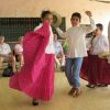
Children demonstrated some of the folk dances.

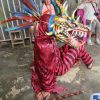
We visited a man who makes masks for the “Red Devil” dances which are held especially during the Fiesta del Corpus Christi in June but also throughout the year.  The dances impersonate the fight between the devil and God.  He starts with molding the clay.  (Two of the tour members worked along with him.)  He sun-dries the clay mask, covers it with vaseline and then covers it with paper mache.  By using vaseline, when everything is dry, he can carefully cut the paper mache and use the clay mold again.  Takes about 4 days.  A young man then demonstrated the dance showing us the costume plus the mask. The costume must be red and black having a tail with a bell.  The dancer carries a stick, has castanets in each hand and wears leather sandals.  Dancers perform 4-6 hours at a time.

Our last visit in the Azuero province was to a fishing village.  On the way we passed the largest salt farms in western Panama.  Ernesto, our fisherman, said that he remembers when there were a lot of fish, and also dolphins and sea turtles near the beach.  No longer.  There are government regulations but they are not enforced.  Ernesto makes his own nets by hand—takes 2-3 weeks and can be 150 metres of netting.  We also observed  large wind turbines.

Our hotel that night was near the International Jazz Festival.  A small group provided a free hour of music at the hotel.  Our room at the hotel looked out over the first set of locks of the Canal.


Panama Highlands

February 2nd, 2018

We flew from Panama City to David, capital of Chiriqui Province, (35 min flight) and then a bus ride to Boquete (another 35 min) where we would be staying the next three nights. Chiriqui means “Valley of the Moon.”  With its more moderate temperatures it is an agricultural province.  Boquete means “sinkhole” and is located in the hole of a volcano that last erupted 400 years ago.  Eighty percent of Panama is at sea level to 500 feet.  The highest point is the edge of the volcano at 11,400 feet which is the highest point in Central America.  We could see this point from our hotel.  Since this is higher ground, many of the residents of Boquete are retirees.  It was definitely a much cooler place than Panama City!  (We also celebrated Ron’s birthday!)

We visited a honey bee farm and had a honey tasting.  They have about 40 different flavors—depending on the floral source to various infusions. Ginger, cinnamon, cocoa, etc.  They teach how to care for the bees and the variety of forage.

Since this is higher elevation than most of the rest of the country, 80% of the vegetable crops of Panama are grown here.  We saw large vegetable fields, orange groves.  The biggest exports for Panama are bananas, pineapples, and watermelons.  Farmers sometimes join cooperatives so that it is easier to sell their products.  They often will make “puercas” – large plastic bags filled with a variety of vegetables.  A family can buy one of these and get a variety of vegetables cheaper than buying the individual items in a supermarket. We stopped at a cooperative where farmers can take their produce which is then sold as “puercas” or individually.  We bought two bags and delivered them to a family farther down the road that our tour leader knew and said could use them.

One day we drove higher up in the highlands (close to 7000 ft).  Along the way we stopped to see a deep gorge created by the volcano.  We also saw “leaf carrying ants.”  We could follow them down the tree trunk, across a long stretch of ground, to their hole.  Fascinating.  We visited the “Finca Dracula” Orchard Nursery.  Beautiful area with some 2,000 species of orchids (some rare species) along with cloud forest type vegetation.  We also walked through their beautiful cloud forest.

We visited the small rural town of Cerro Punta where we climbed a hill to look out over the valleys.  We found the use of old tires in making steps for the trail interesting.  We saw the horse farm which we later visited.  They breed highly prized thoroughbreds who have gone on to win some of the top racing prizes in Central and South America.

On our last morning in the highlands, we opted to do the Canopy Walk – on hanging bridges.  We hiked up through the “cloud forest” and walked over 6 hanging bridges—some of which were quite long and very high above ground in the forest.  We saw a sloth curled up in one tree.  The path was quite steep at times and somewhat slippery with big steps.  It was heart-pounding going up because of exertion and altitude and heart-pounding going down because of fear of slipping!  It was a beautiful area.

Before leaving Boquete we stopped at the flower and coffee fair.  It had opened the night before and would run for about 10 days.  It felt much like our county fairs in the U.S.


Panama City

January 31st, 2018

We arrived a day early and spent the first day on our own.  We visited Ancon Hill, the highest point in Panama City where we had good views in three directions.  Ancon Hill is an area that was used for the administration when building the Panama Canal.  We walked through lovely rain forest to the top (about 30 minutes).  The Panamanian flag at the top is about the size of a basketball court!  The largest flag in Panama.    It is a symbol of national sovereignty after the 1977 signing of the Torrijas-Carter treaty which gave the canal land back to Panama.   The flag was at half-mast the day we visited because it was a holiday – “Martyrs ’Day”, a national day of mourning.  The day commemorates the January 9, 1964 riots over sovereignty of the Panama Canal Zone.  The riot started after a Panamanian flag was torn and some students were killed during a conflict with Canal Zone Policy officers and Canal zone residents.

On the first day of the tour we walked along the beach beside the Pacific Ocean (Cinta Costera = Coastal Beltway).  Much of the area that we walked is new land, created by bringing dirt from the widening of the canal and placing it here around 1980.  Lovely landscaping with lots of possibilities for recreation.

We visited the colonial part of town—Balboa.  Walking through a market and along some streets.  We had a coke in the historic Coca-Cola Cafe, built over 100 years ago.  Many political meetings have taken place here with famous visitors, including Che Guevara, Fidel Castro, Evita Peron, and Jimmy Carter.  We saw buildings bombed by the U.S. when they were trying to capture Manuel Noriega in 1989.  We saw an ancient “horizontal” brick arch which was used to prove to some US politicians (who wanted the canal in Nicaragua rather than Panama) that there were no earthquakes in Panama!

We visited several Catholic churches, one which was built in the Spaniards’ time.  We also visited a Panama hat shop – even though the real “Panama hat” is made in Ecuador!

In the evening we talked to a group of women who are part of a community protesting against the government about their land.  Balboa was made a World Heritage site.  When that happened part of the agreement was that the government would build some residential buildings so that the people who were born and lived on this land would have a home.  Instead the government sold the land to large commercial developers.  There are about 28 families protesting—sitting in the spot 24 hours/day for 4 months already.

We stopped to see the Panama Canal administration building.  It was built on an 85 feet artificial hill to represent the difference in height of the up and down of the canal.  The palm trees in front are in the shape and size of a lock.  A memorial as high as a lock with the names of three locks on the Pacific side is in front of the Administration building.  The Balboa High School is nearby – the site of the January 9 riot.

We took several excursions out of the City.  We visited SOS Children’s Village. This is an international organization which began work in Panama in the 1980s.  They provide homes with “aunties” who care for children who may come from abusive homes or poor homes.  They try to provide a stable home environment until they are either adopted or returned to the parents, or can be independent.

We visited the Harpy Eagle Research Station.   The Harpy is the national bird of Panama.  Also in this area they protect other birds and animals—ones who have been hurt, etc.  Saw macaws, tapir, falcons, etc.

We drove to Gamboa (which is about half-way along the canal) to visit an Embera village.  We first took a small boat into the canal to get our first real look at the canal.  In our small boat, the ships looked very large!  Then we went under a bridge and up the Chagras river which is the main source of water for the canal. Embera are indigenous people of Panama and Columbia.   We visited the village of Katoma which was founded in 1958 by a group of Embera moving up from the Darien region of Panama.  The founder helped train seven astronauts, including John Glenn, in case they landed in the jungle.  He passed away 5 years ago at the age of 97.  They now make their main income in tourism.  We had a lunch in one of the homes—fried tilapia and fried plantain plus some melon.  The wife also drew tattoos (hummingbirds) for each of us from a black dye made from the jaguar fruit.  There are only about 50-70 people in this village.  They performed some dances for us.

Later we took an evening boat ride on the Chagras River.  We saw egrets, heron, fish, bats, caiman, and crocodile.  (It was difficult to get photos in the dark!)

Sedona (2) 2017

November 7th, 2017

Week 2

Saturday, Oct 28

We took a short hike to Chicken Point on the southeast side of Sedona.  We have done this before.  However, as we were starting out we talked to a hiker who has done it many times.  He pointed out another trail close by that we could take and make it more of a loop.  Turned out to be a very nice trail and less busy.  Another cloudless beautiful day for a hike.  Twin Buttes, High on the Hog (part), and Broken Arrow trails (3.62 miles)  Some people ride jeeps in this area and some people even ride mountain bikes over this trail!

Sunday, Oct 29

Hiked to Devil’s Bridge.  We had also done this hike before but tried a new access trail.  Started on part of Mescal trail, then a bit of Chuckwagon trail, to Devil’s Bridge trail (4.39 miles).  Just can’t believe the beautiful weather we are having day after day after day and the beautiful scenery around us day after day after day.  It’s a fairly easy trail until the last bit where it was very steep with large rocks to climb over.  Ron walked out over the natural bridge while Sally Jo was content to stay back and just take a photo of him.  On the way down we took a side path which took us partly under the bridge.

In the evening we walked to sunset point near the resort.  There were no clouds to make a spectacular sunset, but the evening light was beautiful.

Monday, Oct 3

A couple of people had recommended to us the West Fork trail (7.39 miles).  We finally decided to do it today.  It is an out and back trail.  It is considered an easy trail – and it was for the most part.  EXCEPT: the trail includes 13 river/creek crossings – that is 13 crossings ONE way which means 13 x 2 = 26 crossings.  Sally Jo does not like water crossings.  Sally Jo’s heart worked extra hard 26 times today!!!

It was a beautiful trail through the canyon of the West Fork of Oak Creek.  The fall colors were beautiful among the green pines and white and red canyon walls.  The canyon walls themselves were very interesting.

Before beginning the actual West Fork trail, we stopped to see the ruins of an early lodging site.  The first cabin was built in 1870’s and eventually more people built here.  In the 1920’s a log lodge was built and used until 1968.  A fire burnt the dwellings but there are brick remains.  Famous people stayed here – Herbert Hoover, Jimmy Stewart, Walt Disney.  The canyon and its area inspired Zane Gray in his book Call of the Canyon.

We met a number of interesting people along the way, as well as hearing a variety of accents/language.  British, southern U.S., Korean, Indian.  Several people had heard of Goshen either through relatives or from formerly being a Hoosier.  One man was especially interesting as he was carrying – and playing – a didgeridoo!  He also told us that ponderosa pine either smell of honey, coffee, or vanilla.  We tried smelling several pines and indeed verified the smells!

Tuesday, Oct 31

We visited Wupatki National Monument and Sunset Crater National Monument, both northeast of Flagstaff.  Wupatki has a number of ancestral Puebloan villages mostly from the 1100s.  What was especially interesting to us, is that it is thought that some of these early people moved to Mesa Verde (which we visited 2 weeks ago) in the 1200s.  These villages are built above ground rather than in cliffs.  We were able to walk to several of the pueblos and examine the buildings up close.  Visited Lomaki and Box Canyon Pueblos, Citadel Pueblo, Wupatki Pueblo, and Wukoki Pueblo.  We felt that the Visitor’s Center presented the information very well—telling both the Native American viewpoint and the colonist’s viewpoint.

Sunset Crater erupted in the late 1000s—the most recent volcano in this region.  We could see a number of lava flows and large areas of cinders, plus smaller vents as we looked out over the countryside.  Some plants are beginning to grow in areas.

Wednesday, Nov 1

Today we did a hike we have done before—Thunder Mt (1/2 mile), Lower Chimney Rock, Chimney Rock, and Lizard Head (1/2 mile).  It was a 3.82 mile loop—not very far but a lot of up and down.  AND one other caveat—we hiked the summit trail.  We had not done this before. It was strenuous, quite steep with a loose-gravel path.  But the view at the top was magnificent!  The entire hike had great views.

Thursday, Nov 2

We hiked the Doe Mountain trail.  Again, we have done this trail several times but never get tired of the views.  It’s a .06 mile UP and then over a mile of hiking around the mesa top for a total of 2.8 mile hike.  Not long, not strenuous, just beautiful!

Sedona 2017

October 31st, 2017

Week One

This, and the next blog, are just an abbreviated version of our two weeks in Sedona. There are not many photos because we already have hundreds of photos from this area!  It is partly for us to keep track of what we did.  But, of course, we did take some photos – it is just too photogenic of an area not to take pictures!

Saturday, Oct 21

We hiked our usual “first-day-in Sedona” path—the Airport Loop.  The 3.3 mile hike became a 4.65 mile hike since we parked at the top of the mesa and needed to hike ½ mile down to the start of the trail and back.  It was lovely.

Sunday, Oct 22

Sally Jo had picked out new, nice, long, circular hike.  However, when we tried to find the trailhead for the hike, we discovered it was located on a 5-mile rocky road that we could not drive. Since the trail was already going to be 7 miles, we didn’t feel like adding on 5 miles to get to the start.

Re-calculate.  Not far away was a trailhead to Long Canyon.  (6.61 miles) It was trail out and back rather than a loop.  It was a scenic trail along a canyon.  It was helpful that the trail went slightly uphill the entire way so that we could go downhill most of the way back!

Monday, Oct 23

A day at a Ranch. We went to Canyon Creek Ranch near Black Canyon City.  We opted for the hour-long horse ride.  Fun!  Going through the desert area was beautiful, though hot.  Ron tried both skeet shooting and archery. In skeet shooting he hit the target twice!  We had a steak/chicken lunch with some Navajo entertainment.  A nice flute solo and a fantastic hoop dance by the world’s championship dancer, only 17 years old.

Tuesday, Oct 24

We took a short hike to Scheurman Mountain.  (2.77 miles) It was only 1 mile one-way but we were able to start from our resort, rather than driving.  We looked out to the airport mesa, Sedona town, and to our resort.  The high school which is at the beginning of the hike is fully solar-powered.

Wednesday, Oct 25

Hiked Soldier Pass Trail and Jordon Trail.  (6.5 miles)  Even though it is quite long – for us – we think we like these trails the best. The scenery is spectacular and the hike is quite varied.  We hike through pine forest at the beginning, gradually ascending.  The trail goes along the top of a mesa where we can climb a large rock outcrop with fabulous views (and eat lunch), and then a steep descent after which we meander up and down on a path back to the beginning.  The one problem today was the heat and dryness – 85 degrees and 14% humidity.  We felt like dry toast!

Thursday, Oct 26

Took a drive to Jerome with a short stop in Cottonwood on the way.  Walked around Jerome and had lunch.  Decided to drive back to Sedona a different way.  On the map it looked interesting.  Turned out to be an adventure.  Roads started out good but got smaller and smaller.  Through wilderness.  Gravel road.  Beautiful scenery.  Felt uninhabited.  Only one photo.  The afternoon light on the mountains coming back in to Sedona was outstanding.

Friday, Oct 27

Went to Williams to visit a friend.  Elaine and her husband live in a beautiful rural area.  Lots of birds; they also have wild animals, though we didn’t see any.  That morning Elaine had seen a mountain lion in her front yard.  Good time.  No photos.

Mesa Verde National Park, 2017

October 28th, 2017

On our way to Mesa Verde we traveled through Illinois, crossed the Mississippi, Iowa, Nebraska, and Colorado.  In Nebraska we stopped at a Pony Express Station from the 1850s which was interesting. We stopped in Boulder and Denver, Colorado and then drove through some beautiful Colorado autumn scenery.  The aspen especially, were beautiful as they were just beginning to turn colors.

Mesa Verde is located in the southwest corner of Colorado.  We have driven near several times but decided to stop this time.  We spent two nights in the park which gave us a full day of exploring.  We had a room with a balcony overlooking the park. Beautiful.  And dark at night!

The cliff dwellings here are the best preserved in North America.  Sometime during the late 1190s, after primarily living on the mesa top for 600 years, many Ancestral Pueblo people began living in pueblos built beneath the overhanging cliffs.  There are nearly 600 cliff dwellings within the park, ranging from 150 rooms (Cliff Palace) to 1-5 rooms or even single room storage units. One wonders what their life was like.

The park is open all year but the lodge closes the middle of October—or a week after we were there.  Also at this time of the year all but two of the cliff dwelling tours were closed.  (The only way to see the cliff dwellings up-close is with a guided tour.)  When we arrived at the park only one tour, Balcony House, still had openings – it was the one we had read about ahead of time and said we didn’t think we would go.  It involved first descending a 100-foot staircase into the canyon, then climbing a 32-foot ladder, crawling through a 12-foot tunnel (our ranger said it was 1 ranger hat wide and 2 ranger hats high!), and climbing up a 60-foot open rock face with toe holds and stone steps and two 10-foot ladders.  We saw some photos and decided that we could do it after all!

Balcony House has about 40 rooms.  We saw the rooms, kivas, passageways, and plazas built and occupied in the thirteenth century by the ancestors of the Pueblo Indians of Arizona and New Mexico in the cliff alcove.  They were excavated and stabilized in the early part of the twentieth century.  Our guide was half Native American and had good insights into Native America culture and philosophy.

In the afternoon we hiked the Petroglyph Point Trail.  This is a loop trail that in parts was quite rocky with several areas of narrow steep stairs.  But the views of the canyons are amazing.  The 20-foot wide panel is the largest group of petroglyphs in Mesa Verde.  The designs include hand prints, animals, humans, spirals, and other geometric shapes.  In 1942 four Hopi men visited the area and interpreted some of the glyphs.  The guidebook gives those modern day interpretations which may or may not have been the same as the original rock artists actually thought.  But it was interesting!

Overall, we were very happy that we visited.  Highly recommended!


MCC picnic

March 5th, 2017

The Dhaka MCC office family picnic finally happened!  We had heard about this picnic for a long time and how everyone was looking forward to it.  Sometimes all three offices gather for one picnic but this year that didn’t work.  So each office held their own.  We were told that everyone dresses up, there would be games, and lots of food.  All this was true!

Many of the women wear saris or beautiful salwa kameez.  Sally Jo was expected to wear a sari but was given permission to change half way through the day.  There were games for three levels of children and games for the adults (men did musical chairs and women tried to throw a ball in a basket).  And lots of food!  For about 50 people (including children), they cooked 25 lbs of rice, 2 goats, chicken, fish, kebabs, and the inevitable sliced cucumbers, carrots, and tomatoes.  It was excellent food – just a lot!

We all traveled by bus to Sonargaon, the old capital of medieval Bengal.  However, as is so often the case, we had traffic jams and it took 4 ½ hours to go 20 miles and it was hot!  Thankfully, at the end of the day, we had smooth sailing and returned to Dhaka in an hour.

One of the attractions of Sonargaon is its Folk Art Museum located on over 100 acres of land and lakes.  There are two main buildings and many art pieces located across the landscape.  There are exhibits of wooden crafts, brass, bamboo and metal crafts, painted work, musical instruments, pottery, textiles, ornaments and much more.  One of the buildings was closed but we visited the other – along with 100s of local Bangladeshis.  In fact, it was so crowded, we could barely see the exhibits.

Most of the outdoor sculptures are of the Alpana art form, an ancient kind of folk art.  One of the Bangladeshi’s that was with us translated it as “creative burst of mind/emotions.”  It may be an ancient form but it felt contemporary.

Panam Nagar, located not far from the Museum, is a former Hindu settlement dating to the early 13th century.  During British colonial rule and a prosperous cotton textile industry, Panam Nagar became home to upper-middle class Bengali businessmen in the late 1800s.  The migration of the Hindus to India after the Indo-Pak War of 1965 and Muslim-Hindu riot made Panam Nagar into a vacant community.  There are 52 beautiful houses along this one street incorporating European, Mughal, and Bengali architecture.

We all had free time to visit both the Museum and Panam Nagar.  We also had speeches and gifts.  Ron of course needed to make a speech and we both helped distributed flowers and gifts to each family.  It was fun to see spouses and children of our co-workers.

Nepal Retreat (3)

March 3rd, 2017

The retreat itself was very good.  The location was beautiful and the vegetarian cuisine was outstanding.   We could have taken photos of every meal because the plates were so artistically arranged.  The first day we enjoyed the lovely hills and then the mountains appeared two of our five days.  What a view!

We stayed in small, simple cottages.  We had a toilet in ours but needed a 5 minute hike up and down the hill to get to the shower.  The photo we have of the inside of our cottage actually does not show the sleek lines of design because we brought one of the beds down from the loft so that one of us could be near the toilet- sick for more than a day.

We had sessions every morning with optional activities in the afternoon.  It was a very relaxful, laid-back retreat with lots of time just for visiting.  We learned to know the service workers and the SALT/YAMEN young people.  We met a couple who have been in Afghanistan but are moving to Bangladesh.  Even though few of you reading this will know anyone (other than us!), we have included a photo of the whole group.

At the end of Retreat we travelled back to Kathmandu (by bus) and spent the final night there.  We had a free morning before our flight and again had fun walking the streets.

Nepal Retreat (2)

March 2nd, 2017

One afternoon during Retreat several of us hiked to the Namo Buddha shrine and monastery.  Again beautiful scenery.

The story of the Namo Buddha: One day a prince was walking in the hills and came upon a starving tiger and her cubs. The tiger was so desperate she was about eat her cubs. Moved with compassion the prince offered his body to the tigers. That prince was later reincarnated as the Buddha.

This shrine is said to be where the prince made his sacrifice. It is one of the holiest pilgrimage sites in Nepal.  Recognizing the extraordinary sacrifice the prince made, the nearby villagers buried his bones beneath the stupa at this shrine.

We attended a service at the monastery but were not allowed to take photos.  (This monastery is of the Tibetan tradition.)  There was much chanting and horn blowing.  Fascinating and moving.  The inside of the temple was very reminiscent of the ones we saw in Tibet with beautiful colors and streamers of Tibetan cloth.  The monastery is home to more than 250 monks and includes a monastic college, a school for young monks and a Tibetan Medical clinic.

The following is a description taken from the website:

In the center is the main temple building, which is six stories high with another added by the curved golden roof in the Indian style. Counting from the ground up, the principal temple hall is located on the fourth floor. It has thirty-six pillars, each of which enshrines a gilded bronze Buddha at the top. In the front of the hall are statues of the Seven Generations of Buddhas made in Bangkok. … Behind these seven, a Thousand Buddhas of the Fortunate Era fill the rows of alcoves. Fifteen mandalas from the great tantras adorn the ceiling. Hidden behind the main shrine is a special sanctuary, and outside in the front of the building is a wide veranda.

I “stole” a photo of the larger site since I was unable to get a good one.